Studies
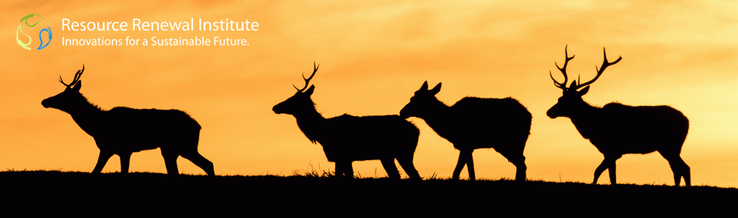
The purpose of this 1998 NPS management plan and environmental assessment (EA) was to guide the management, monitoring, and research of Tule’elk (Cervus elaphus nannodes) at Point Reyes National Seashore for five to ten years. It was developed to provide for the protection of the native elk and was consistent with then-scientifically sound principles, taking into account the interests of the public and meeting the objectives for which the Seashore was established. There have been no revisions to the management plan since 1998, despite extreme drought and major Tule elk die offs in 2015-2016, and demands by ranchers to further restrict the elk. Although it is now 20 years old, the Tule Elk Management Plan and EA will not be addressed in the forthcoming General Management Plan Amendment (GMPA). Read more here.
Citation: National Park Service. (1998). Tule Elk Management Plan and Environmental Assessment, 1998. Point Reyes National Seashore, Point Reyes, California.
The NPS 2001 biological assessment (BA) reviewed the proposed renewal of livestock grazing permits for areas managed by Point Reyes National Seashore (PRNS) in order to determine the extent to which the proposed action could affect any of the federally listed threatened or endangered species found at Point Reyes. Current management practices, current grazing activities, and affected species can be found on Pages 1-15. All permitted livestock practices in the park are driven by this document. Read more here.
Citation: National Park Service. (2001). Biological Assessment on the Renewal of Livestock Grazing Permits in Point Reyes National Seashore and the North District of Golden Gate National Recreation Area Marin County, California. Point Reyes National Seashore, Point Reyes, California.
The California red-legged frog (Rana aurora draytonii) is federally listed as a threatened species. It has been extirpated from 70 percent of its former range and now is found primarily in coastal drainages of central California, from Marin County, California, south to northern Baja California, Mexico.
The recovery plan delineates reasonable actions needed to recover and/or protect listed species. It is unknown to what extent the recommended recovery and protection practices have been implemented by the NPS or to what extent this has supported the conservation and restoration of red-legged frog populations at the Seashore. Read more here.
Citation: U.S. Fish and Wildlife Service. (2002). Recovery Plan for the California Red-legged Frog (Rana aurora draytonii). U.S. Fish and Wildlife Service, Portland, Oregon. viii +173 pp.
Historical Research Associates, Inc., this report is regarded as the definitive history of Point Reyes National Seashore. The 400+ page document, published in 2007, covers 150 years of history from early conceptions of Point Reyes National Seashore (Pages 11-62), to the legislative history (Pages 71-141), to planning and management topics that extend to the 21st century (Pages 152+). This is an important reference for anyone interested in understanding the nuances of the Seashore’s administrative history. Read more here.
Citation: Sadin, P. (2007). Managing a Land in Motion: An Administrative History of Point Reyes National Seashore. Historical Research Associates, Inc., Seattle, Washington.
The major source of nonpoint source pollution into Point Reyes waterways is cow manure. The purpose of this research was to assess the effectiveness of ten demonstration Best Management Practices (BMPs) at reducing nonpoint source pollutant delivery from the pastoral lands within PRNS and the North District of Golden Gate National Recreation Area (GGNRA) to the Tomales Bay Watershed. Project scope: 1) identify persistent nonpoint sources of pollution from pastoral lands; 2) implement ten demonstration BMPs to reduce pollutant loading to waterways in the Tomales Bay Watershed; 3) monitor water quality pre-and post-BMP implementation to establish baseline data and quantify reductions achieved through the performance of the BMPs. Read more here.
Citation: DiGregoria, J. and Eisenberg, B. (2008). Tomales Bay Rangeland Best Management Practices (BMPs) Pathogen Total Maximum Daily Load (TMCL) Implementation Project FINAL REPORT (SWRCB Agreement # 05-129-552-0). Point Reyes National Seashore, Point Reyes, California.
Commercial agriculture is the largest emitter of greenhouse gas (GHG) emissions in this National Park unit, with cattle the largest source. This 2010 plan identifies steps the NPS has committed to undertake to reduce GHG emissions and mitigate future impacts of climate change. The plan presents the Seashore’s emission reduction goals and associated actions and adaptation strategies to achieve those goals. No updated publication has documented whether or not emissions have decreased since the action plan was published. Read more here.
Citation: National Park Service. (2010). CLIMATEFriendly PARKS, Point Reyes National Seashore Action Plan. Point Reyes National Seashore, Point Reyes, California.
Cattle impacts, including waste run off, have led to high levels of pollution in the coastal watersheds and the bodies of water surrounding Point Reyes National Seashore. This report includes recommendations for assessing (Pages 31-70); and minimizing impacts (Pages 115-181) to coastal watersheds.
The extent to which the NPS and its cooperating partners’ have implemented the recommendations, or minimized the damage to watersheds since the publication of this document in 2013 is not a matter of public record. Read more here.
Citation: Pawley, A. and M. Lay. 2013. Coastal watershed assessment for Golden Gate National Recreation Area and Point Reyes National Seashore. Natural Resource Report NPS/PWR/NRR—2013/641. National Park Service, Fort Collins, Colorado.
Over the last 100 years native and non-native ungulates in parks have been introduced, reintroduced, fed, hunted, shot by sharpshooters, rounded-up for live transfer or slaughter, herded out of parks, fenced in parks, fenced out of parks, euthanized, or treated with contraceptives. This cumulative history of NPS ungulate management, published in 2014, is one of the guiding NPS documents for managing animals like deer and elk to achieve optimal long-term management of ungulates. It is very helpful to understanding how the NPS views wildlife management of Tule elk. Read more here.
Citation: National Park Service (2014). A comprehensive review of ungulate management by the National Park Service: Second century challenges, opportunities, and coherence. Natural Resource Report NPS/NRSS/BRMD/NRR—2014/898. National Park Service, Fort Collins, Colorado.
Some of last remaining high-quality coastal dune habitat in the United States exists at Point Reyes National Seashore. The Seashore’s dunes provide habitat for up to 11 federally listed species. The primary species using these dunes are the threatened Western snowy plover, endangered Myrtle’s silverspot butterfly; and the endangered plants, beach layia, and Tidestrom’s lupine. This 2015 EA provides guidance for removing the highly invasive, non-native plant species that have greatly altered dune structure, natural processes such as sand movement, vegetation communities, and restoring habitat function for native plants. Read more here.
Citation: National Park Service. (2015). Coastal Dune Restoration Environmental Assessment (January 2015). Point Reyes National Seashore, Point Reyes, California.
Residual Dry Matter (RDM is the unit of measurement of plant material remaining in a field at the end of the grazing season. This 2015 report on for Point Reyes National Seashore evaluates data collected from 1987-2014 to determine if the methods and standards used in monitoring remain appropriate for grazing activities managed by the Seashore. Managing for a specific RDM level is a common practice used to protect soils from erosion and nutrient loss and to maximize forage production in the following year. The most recent results for each ranch can be found on Pages 57-83. Read more here.
Citation: Bartolome, J., Hammond, M., Hopkinson, P., & Ratcliff, F. (2015). 1987-2014 Residual Dry Matter Analysis Report and Updated Rangeland Monitoring Guidelines for Livestock Grazing Grasslands within Point Reyes National Seashore and Golden Gate National Recreation Area. University of California, Berkley Department of Environmental Science, Policy, and Management, Berkley, California.
Silage farming takes place on approximately 1,069 acres of the National Seashore. This study, conducted by Point Blue Conservation Science in 2015, estimates the impacts of silage mowing on breeding birds at the Seashore and provides recommendations to reduce these impacts. The extent to which the recommendations have been implemented by the NPS or the ranchers, or any improvements to the documented impacts on nesting birds since the publication of this document in 2015 are not a matter of public record. (Pages 14-18). Read more here.
Citation: DiGaudio, R. T., Humple, D. L., & Gardali, T. (2015). Estimating Impact of Mowing in the Silage Fields of Point Reyes National Seashore on Breeding Birds: Final Report to the National Park Service. Point Blue Conservation Science, Petaluma, CA.
“W
e strongly believe it is in the national interest to capitalize on the few remaining clear opportunities to save our vanishing shoreline for public recreational use, particularly the very few still unspoiled and outstanding shoreline areas near large concentrations of population…. It seems to us…that Point Reyes peninsula presents such a clear opportunity….”
Congressman Clem Miller and Senator Clair Engle
Joint statement upon introducing the Point Reyes National Seashore bills to the 87th Congress, January, 1961